|
What is needed is cleaner land-use data separate from elevation contours. One convenient source of this type of data is the USGS Digital Line Graphics (DLG) data base. Unlike the DEM database, which is essentially raster data, the DLG is a vector data base file, so it can handle many types of data suitable for overlay. Depending on the area of interest, one or more DLG files will be available for each of the 1:25000 large scale USGS quads. These files are also available at USGS Geographic Data Download.
There are several possible ways to overlay DLG data on a DEM, all of which are mildly cumbersome. My method requires first converting the target DLG file to DXF format. This can be done using the program SDTS2DXF written by Sol Katz of the Bureau of Land Management. Then, use Microdem to do the overlay. Microdem will do the edge match automatically. (Microdem is supposed to be able to overlay the SDTS .DLG file directly but this feature apparently does not work.)
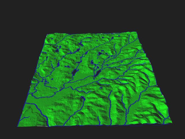
The next step is to black out the DEM data by changing elevation colors to 'IHS'. This yields the overlay features on a stark black background. Then, import the overlay to your favorite image-processing software. Flood fill the black with something like green and save the file as a bitmap. Now you are ready overlay the rasterized vector data and render in POV-RAY as before. An example of this technique is shown at right. The river and stream features for the Salem, NY example area have been overlayed on the DEM to produce a useful drainage basin map.
|